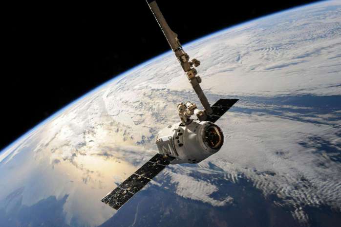
Satellite Imaging: See the World Like Never Before
5 min read
05 Sep 2025
Satellite imaging technology has revolutionized our ability to observe and analyze the Earth's surface from space. This article explores the applications, advancements, benefits, challenges, and future trends of satellite imaging.
Applications of Satellite Imaging
Environmental Monitoring: Tracking deforestation, climate change effects, natural disasters, and biodiversity through high-resolution satellite imagery.
Urban Planning: Using satellite data for urban growth analysis, infrastructure development, and disaster risk management.
Agriculture and Forestry: Optimizing crop health assessment, soil moisture analysis, and forest management through satellite-based remote sensing.
Advancements in Satellite Imaging
High-Resolution Imaging: Capturing detailed images with improved spatial resolution, enabling precise mapping and monitoring applications.
Multi-Spectral and Hyperspectral Imaging: Analyzing Earth's surface characteristics, vegetation health, and mineral composition through advanced spectral bands.
Synthetic Aperture Radar (SAR): Penetrating clouds, vegetation cover, and darkness to capture radar images for land and ocean monitoring.
Benefits and Impact
Global Coverage: Providing comprehensive coverage of remote and inaccessible regions, facilitating global environmental monitoring and disaster response.
Data Accessibility: Enhancing data availability and accessibility for researchers, governments, and organizations worldwide through open-access satellite data initiatives.
Scientific Research: Supporting scientific studies, climate modeling, and policy-making with long-term satellite data archives and trend analysis tools.
Challenges and Considerations
Cost and Infrastructure: Managing the high costs of satellite deployment, data acquisition, ground station infrastructure, and satellite data processing.
Data Integration and Analysis: Overcoming challenges in integrating multi-source satellite data and conducting complex spatial analysis for decision-making.
Ethical and Legal Issues: Addressing concerns related to privacy, data ownership, and international regulations governing satellite imagery and remote sensing technologies.
Future Trends in Satellite Imaging
Next-Generation Satellites: Launching advanced Earth observation satellites with improved imaging capabilities, real-time data transmission, and autonomous operations.
AI and Machine Learning: Integrating AI algorithms for automated image analysis, feature extraction, anomaly detection, and predictive modeling from satellite imagery.
Climate Resilience and Sustainability: Harnessing satellite data to monitor climate change impacts, support sustainable development goals, and enhance global environmental stewardship.
Conclusion
Satellite imaging continues to redefine our understanding of the world and empower us to address pressing global challenges. As technology advances and data accessibility improves, satellite imaging will play a pivotal role in shaping a more sustainable and resilient future for humanity and the planet.
More Articles
Exploring Explainable AI: Making Machine Learning Models Transparent
4 min read | 19 Oct 2025

The Role of AI in Autonomous Vehicles: What’s Next for Self-Driving Cars?
3 min read | 18 Oct 2025

How AI is Transforming Finance: From Robo-Advisors to Fraud Detection
3 min read | 17 Oct 2025

AI in Retail: How Machine Learning Is Personalizing Shopping Experiences
3 min read | 16 Oct 2025
More Articles

Wi-Fi 6: The Next Generation of Wireless Technology
6 min read | 08 Oct 2025

Mesh Wi-Fi: How to Eliminate Dead Zones in Your Home
4 min read | 07 Oct 2025
Fixed Wireless Access (FWA): The Future of Rural Connectivity
7 min read | 06 Oct 2025
Broadband: The Lifeline of the Digital World
5 min read | 05 Oct 2025